 vesseltracker.com
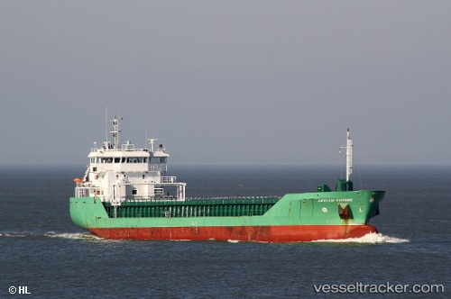
Vessel HAV SUND IMO: 9361768, MMSI: 231075000 General Cargo Ship
UTC, 58.23946, 8.37598, course: 41, speed: 0
UTC, 58.23945, 8.37599, course: 41, speed: 0
2026-02-01 15:35:29 UTC, 58.23945, 8.37598, course: 41, speed: 0
Live AIS position:
UTC. Near Lillesand),
updated 2026-02-01 15:35:29 UTC.
Find the position of the vessel HAV SUND on the map. The latter are known coordinates and path.
marine traffic ship tracker show on live map
The current position of vessel HAV SUND is 58.23945 lat / 8.37598 lng. Updated: 2026-02-01 15:35:29 UTCCurrently sailing under the flag of Faroe Islands
HAV SUND built in 2008 year
Deadweight:
4950 tDetails:
Last coordinates of the vessel:
UTC, 58.23945, 8.37598, course: 41, speed: 0UTC, 58.23946, 8.37598, course: 41, speed: 0
UTC, 58.23945, 8.37599, course: 41, speed: 0
2026-02-01 15:35:29 UTC, 58.23945, 8.37598, course: 41, speed: 0